

Maritime Compliance Software: From Data to Decisions
The Gap Between Vessel Data and Real Maritime Compliance Is Wider Than Most Organizations Realize
There's a version of maritime compliance that looks rigorous on paper — regular vessel screenings, updated sanctions lists, documented review processes — but actually provides much less protection than the people relying on it believe.
The gap isn't usually negligence. It's an information architecture problem. The data that would reveal a compliance concern often exists somewhere in the maritime intelligence ecosystem, but it's not connected, not analyzed, and not surfaced in a way that allows a compliance team to act on it in time to matter.
Understanding that gap — and what it takes to close it — is the starting point for any organization that takes maritime compliance seriously and wants to build a program that actually works in the current regulatory and operational environment.
Why the Volume of Maritime Activity Makes This Hard
The scale of global maritime traffic is genuinely staggering. At any given moment, roughly 50,000 merchant vessels are operating worldwide, collectively making hundreds of thousands of port calls annually and carrying approximately 90% of international trade by volume. That's the universe within which compliance teams are expected to identify the specific vessels, voyages, and counterparties that represent genuine regulatory and sanctions risk.
Even with access to AIS data for every vessel — which itself requires significant data infrastructure — the raw feed is too voluminous and too raw to be actionable without analytical processing. Identifying which vessel, among thousands transiting a specific region, has exhibited behavior consistent with a sanctions violation requires the ability to compare actual behavior against expected behavior, and to do that comparison in something close to real time.
Manual analysis at this scale is not a viable compliance strategy. The organizations that are genuinely ahead of their maritime compliance obligations have recognized this and shifted to a technology-first approach that uses AI and machine learning to do the analytical work that compliance teams can't do by hand.
The Behavioral Intelligence Advantage
One of the most powerful capabilities in modern maritime compliance software is behavioral intelligence — the ability to characterize a vessel's typical movement patterns and flag deviations that warrant investigation.
This matters because the most sophisticated evasion techniques are behavioral, not documentary. A vessel that appears to be compliant based on its registration, ownership, and stated cargo might be engaged in illicit activity that's only visible if you're watching how it actually moves — where it stops, for how long, whether those stops are consistent with the documented voyage, whether it frequently visits ports associated with particular sanctions regimes, and whether its transponder behavior shows the patterns associated with AIS manipulation.
Maritime compliance software that incorporates behavioral analytics — not just position tracking — identifies these patterns automatically. It doesn't require a compliance analyst to notice that a particular vessel has been showing unusual behavior for the past three voyages. The system flags it, contextualizes it against the vessel's historical patterns and peer group behavior, and surfaces it for human review.
Privateer's TerraScope Maritime capability, embedded within the Elements platform, does exactly this — automatically identifying trends, detecting anomalies, and anticipating behaviors across the full scope of global vessel traffic. This isn't incremental improvement on legacy tracking tools. It's a fundamentally different capability class that changes what maritime compliance teams can actually see and act on.
The Role of Satellite Imagery in Compliance Validation
AIS data tells you what a vessel is broadcasting about its position. Satellite imagery tells you where a vessel actually is. In a compliance context, that distinction is critical.
Vessels engaged in sanctioned activity — ship-to-ship transfers in prohibited waters, calls at designated ports, movements through restricted zones — have strong incentives to manipulate or disable their AIS signals. A vessel that shows itself in one location while actually operating in another is exploiting the gap between what the AIS feed shows and what physical observation would reveal.
Closing that gap requires synthetic aperture radar and optical satellite imagery that can detect and identify vessels regardless of their transponder status, cross-referenced with AIS data to identify discrepancies between broadcast position and actual position. This multi-source correlation is not something traditional maritime tracking platforms do well — but it's fundamental to the geospatial intelligence platform architecture that Privateer Elements is built on.
The ability to fuse satellite imagery with behavioral data and AIS records into a single analytical framework — and to do that continuously across the full scope of global maritime traffic — is what separates genuine maritime compliance capability from compliance theater.
Financial Institutions and the Maritime Compliance Obligation They Often Underestimate
Banks, insurers, and trading firms with maritime exposure have compliance obligations that are sometimes less visible than those of shipping companies themselves — but that are no less real from a regulatory and reputational standpoint.
A financial institution that finances a vessel subsequently found to have been engaged in sanctioned cargo shipments has a problem, even if the financing was extended in good faith based on a screening that was current at the time. The question regulators and courts ask is not just "did you screen it at origination?" but "did you have adequate ongoing monitoring to identify changes in the vessel's risk profile during the life of the exposure?"
That's a maritime compliance software question. Ongoing monitoring of financed vessels — tracking their movements, screening their counterparties, flagging behavioral changes that may indicate heightened risk — requires continuous automated surveillance, not periodic manual review. For an institution with dozens or hundreds of shipping sector exposures, manual ongoing monitoring is simply not feasible.
The same logic applies to marine insurance underwriters monitoring their hull and cargo books, commodity trading firms tracking vessels carrying their inventories, and energy companies monitoring LNG and crude carriers through complex multi-leg voyages.
Building a Compliance Architecture That Actually Scales
The compliance architectures that are most resilient — and most defensible to regulators — share a common characteristic: they're systematic rather than opportunistic. They monitor continuously rather than screening episodically. They use AI to handle scale and surface what's significant rather than relying on analysts to find needles in haystacks.
Privateer's Elements platform is designed to support this kind of systematic architecture across multiple domains simultaneously. Elements: Sea addresses maritime intelligence and maritime compliance software requirements. Elements: Land extends the same analytical capabilities to land-based supply chain and infrastructure monitoring. Elements: Air and Elements: Space extend geospatial intelligence to airspace and orbital environments.
For organizations with multi-domain exposure — an energy company that needs to track upstream extraction, maritime transport, and downstream infrastructure simultaneously — the ai-based geospatial analytics platform architecture of Elements provides a single environment for multi-domain intelligence without requiring separate tools, separate data flows, and separate analyst workflows for each domain. That integration is itself a compliance advantage: it reduces the risk that a multi-domain compliance concern falls through the gap between siloed monitoring systems.
From Complexity to Clarity
The pitch from legacy maritime tracking vendors has often been "more data, more feeds, more coverage." The Privateer Elements approach inverts that: the value isn't in accessing more raw data. It's in converting complex, multi-source data into clear, actionable knowledge — surfacing what matters, providing the context to understand why it matters, and delivering it in a format that enables decisions rather than requiring additional analysis to become useful.
That distinction matters enormously for commercial organizations that don't have dedicated geospatial intelligence teams. Elements is designed to work without specialist analysts. Business leaders and compliance professionals interact with decision-ready outputs, not raw satellite feeds and AIS streams.
Take the First Step Toward Stronger Maritime Compliance
If your current maritime compliance program is built on periodic screening and AIS monitoring, there are gaps in your coverage that you may not be aware of — because the nature of those gaps is that they're not visible without the analytical capability to find them.
Privateer's team is available to walk through how Elements addresses your specific maritime intelligence and compliance requirements. Visit privateer.com/products/commercial and get in touch to schedule a demonstration. What you don't know about your maritime exposure may be the most important compliance risk you're currently carrying.
Categorie
Leggi tutto
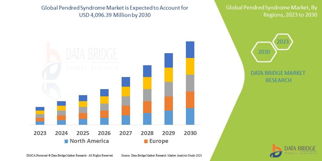
Global Demand Outlook for Executive Summary Pendred Syndrome Market Size and Share CAGR Value Data Bridge Market Research analyses that the global pendred syndrome market, which was USD 2,858.56 Million in 2022, would rocket up to USD 4,096.39 Million by 2030 and is expected to undergo a CAGR of 4.6% during the forecast period. Pendred Syndrome Market report supports businesses to...
The landscape of online networking and local classified platforms has evolved dramatically over the last few years. Among the platforms that have sparked significant discussion and curiosity across Southeast Asia is fiwfan. Navigating this platform in 2026 requires a clear understanding of what it is, how its layout functions, and the core practices necessary to ensure digital safety and...

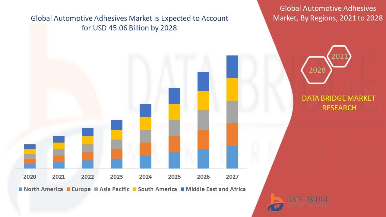
The Automotive Adhesives Market is undergoing structural expansion as OEMs pursue lightweight multi-material vehicle architectures, improved NVH (noise, vibration & harshness) performance, and increased automation in assembly. For the detailed Databridge analysis consult:Databridge — Automotive Adhesives Market. Market Overview Automotive adhesives enable structural bonding,...